| AGNES station AIGE | ||||||

|
|
GNSS receiver: | LEICA GR50 | |||
| GNSS antenna: | TRM59800.00 NONE | |||||
| Antenna height: | 0.000 m | |||||
| Phase center L1: | 0.090 m | |||||
| Phase center L2: | 0.117 m | |||||
| PCV antenna model: | Absolute PCV antenna model (ATX format) | |||||
|
Reference coordinates: |

|
|||||
| CHTRF/ETRF93: | ||||||
| X = 4393543.635 | φ = 46° 14' 51.983742" | |||||
| Y = 471726.020 | λ = 6° 7' 41.725009" | |||||
| Z = 4584678.463 | h = 473.858 | |||||
| LV95 (CH1903+): | ||||||
| E = 2498943.440 | ||||||
| N = 1122661.169 | ||||||
| h = 421.465 (Bessel) |
Receiver+antenna valid since: 06.11.2024
Information update: 26.07.2026
|
|||||

|
Sitelog in IGS/EUREF format. |

|
Documentation of changes at the stations. |

|
Compilation of important quality characteristics. |
|
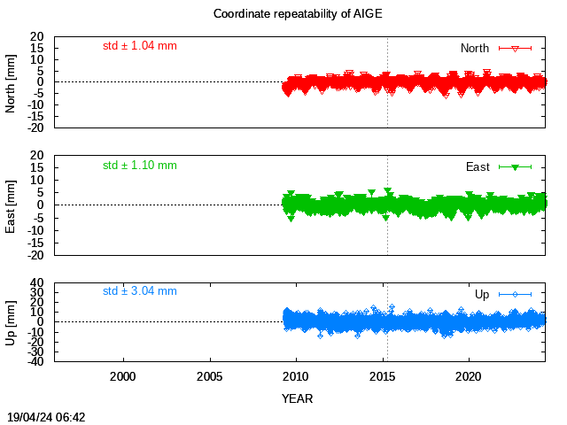
Time series of coordinates (daily solutions). |
|
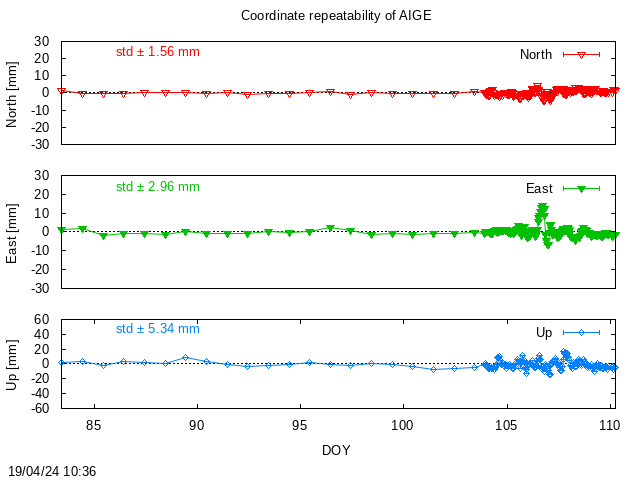
Monitoring of coordinates (last days). |
|
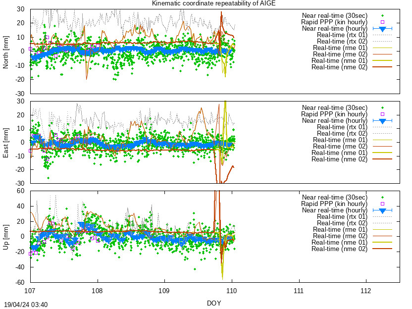
Monitoring of coordinates (last hours) |

|
Monitoring of the troposphere parmeters (last hours). |
Location of station AIGE:
Map 1:25 000
map.admin.ch: web-zoom , Control Point Viewer
Other Geodata Portals