| AGNES station ARDE | ||||||

|
|
GNSS receiver: | LEICA GR50 | |||
| GNSS antenna: | TRM33429.20+GP NONE | |||||
| Antenna height: | 0.000 m | |||||
| Phase center L1: | 0.073 m | |||||
| Phase center L2: | 0.067 m | |||||
| PCV antenna model: | Absolute PCV antenna model (ATX format) | |||||
|
Reference coordinates: |

|
|||||
| CHTRF/ETRF93: | ||||||
| X = 4307656.783 | φ = 46° 46' 34.991592" | |||||
| Y = 775433.609 | λ = 10° 12' 16.874324" | |||||
| Z = 4625902.691 | h = 1546.621 | |||||
| LV95 (CH1903+): | ||||||
| E = 2811209.612 | ||||||
| N = 1184302.375 | ||||||
| h = 1499.482 (Bessel) |
Receiver+antenna valid since: 13.11.2024
Information update: 26.07.2026
|
|||||

|
Sitelog in IGS/EUREF format. |

|
Documentation of changes at the stations. |

|
Compilation of important quality characteristics. |

|
Time series of coordinates (daily solutions). |
|
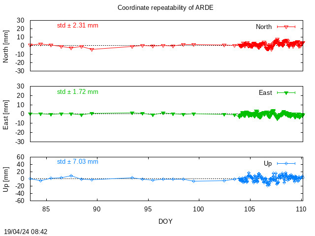
Monitoring of coordinates (last days). |

|
Monitoring of coordinates (last hours) |

|
Monitoring of the troposphere parmeters (last hours). |
Location of station ARDE:
Map 1:25 000
map.admin.ch: web-zoom , Control Point Viewer
Other Geodata Portals