| AGNES station BOUR | ||||||
|
|
GNSS receiver: | LEICA GR50 | |||
| GNSS antenna: | TRM33429.20+GP NONE | |||||
| Antenna height: | 0.000 m | |||||
| Phase center L1: | 0.073 m | |||||
| Phase center L2: | 0.067 m | |||||
| PCV antenna model: | Absolute PCV antenna model (ATX format) | |||||
|
Reference coordinates: |

|
|||||
| CHTRF/ETRF93: | ||||||
| X = 4291771.995 | φ = 47° 23' 38.887284" | |||||
| Y = 544504.832 | λ = 7° 13' 50.117269" | |||||
| Z = 4672230.035 | h = 940.165 | |||||
| LV95 (CH1903+): | ||||||
| E = 2584293.739 | ||||||
| N = 1249277.899 | ||||||
| h = 891.528 (Bessel) |
Receiver+antenna valid since: 09.10.2024
Information update: 26.07.2026
|
|||||

|
Sitelog in IGS/EUREF format. |

|
Documentation of changes at the stations. |

|
Compilation of important quality characteristics. |

|
Time series of coordinates (daily solutions). |

|
Monitoring of coordinates (last days). |

|
Monitoring of coordinates (last hours) |

|
Monitoring of the troposphere parmeters (last hours). |
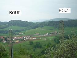
Location of station BOUR:
Map 1:25 000
map.admin.ch: web-zoom , Control Point Viewer
Other Geodata Portals